From Passive Roads to Intelligent Infrastructure: The Role of RFID in Autonomous Driving
The progress of autonomous driving is often described as a competition in algorithms, computing power, and sensors. In reality, it is increasingly becoming a systems challenge—one that depends on how effectively vehicles and roads can work together. Relying solely on cameras, millimeter-wave radar, or LiDAR still leaves autonomous vehicles vulnerable to unstable recognition, environmental interference, and high system redundancy costs. Against this backdrop, RFID technology is being re-evaluated, gradually moving from logistics and manufacturing into intelligent road infrastructure and RFID vehicle management systems.
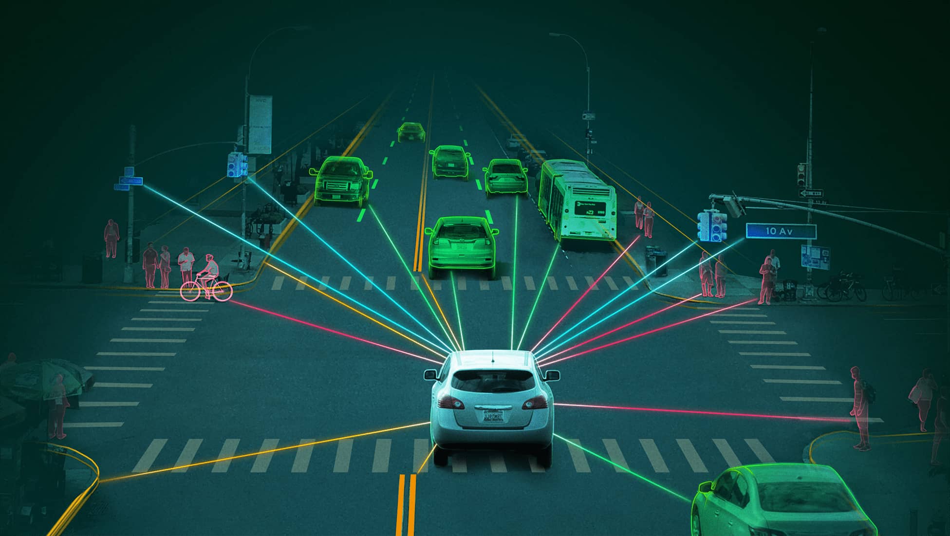
Most autonomous vehicles today interpret road conditions through visual and radar-based perception. Lane markings, traffic signs, signals, and obstacles are detected passively, based on what sensors can observe at a given moment. Under ideal conditions, this works well. However, rain, snow, fog, glare, worn lane markings, or temporary construction zones quickly expose the limits of this approach. The road itself remains silent, offering no direct confirmation of what a vehicle believes it sees.
RFID markers change this relationship. By embedding RFID tags into key road elements—lanes, intersections, speed-control zones, construction areas, and roadside infrastructure—the road gains a digital identity that can be read directly by vehicles. With properly designed UHF RFID antennas installed on vehicles or embedded near the roadway, information can be captured reliably without dependence on visibility or lighting conditions.
In road environments, RFID typically takes the form of passive UHF tags or ruggedized, weather-resistant markers installed beneath the road surface, along curbs, within guardrails, or inside traffic facilities. Autonomous vehicles equipped with onboard RFID readers can automatically detect these markers as they pass, without any active interaction.
To support stable reading at driving speeds, vehicles often integrate a long-range RFID reader module, allowing tags to be identified early enough for decision-making. Each tag can store standardized information such as road classification, speed limits, lane attributes, intersection identifiers, or warnings related to temporary conditions. When integrated with high-definition maps and vehicle control systems, RFID enables vehicles to anticipate road conditions rather than react to them.
High-precision positioning remains one of the most difficult challenges in autonomous driving. Even when combining GNSS, inertial measurement units, and visual SLAM, location drift can occur in tunnels, dense urban areas, or locations with poor satellite coverage.
RFID markers provide fixed physical reference points. Each time a vehicle reads a tag, it can recalibrate its position with high confidence. This approach has proven particularly valuable in tunnels, underground roads, ports, industrial parks, and logistics hubs—environments where RFID-based vehicle management already plays an important operational role. Rather than replacing satellite navigation, RFID strengthens the overall positioning framework.
Beyond static road data, RFID can also support semi-dynamic traffic information. In construction zones, accident-prone areas, or special weather-affected sections, updated RFID tags can deliver localized instructions without relying on complex communication networks. Vehicles receive these signals instantly and can adjust speed, lane selection, or route planning accordingly.
Because RFID data is standardized and location-specific, it can be shared across different autonomous platforms. This consistency helps reduce behavioral discrepancies between vehicles and supports safer large-scale deployment on shared roads.
RFID is not intended to replace cameras or radar systems. Instead, it functions as a complementary layer within a multi-sensor architecture. Vision systems excel at identifying dynamic objects, radar handles distance and velocity, while RFID provides reliable identity confirmation and rule-based road information.
When visual recognition becomes uncertain, RFID offers clear and deterministic guidance. When environmental conditions fluctuate, RFID remains stable. This layered design aligns with the broader evolution of intelligent transportation systems.
From an infrastructure perspective, RFID road markers offer practical advantages. Passive tags require no power supply, have long service life, and demand minimal maintenance. Once installed, they operate continuously in the background. Compared with dense camera networks or roadside communication units, RFID solutions are often easier to scale and maintain.
Closed or semi-closed environments—such as logistics parks, ports, mining areas, airports, and industrial zones—are already well suited for RFID-enabled road systems. As standards mature, broader public-road adoption becomes increasingly feasible.
The future of autonomous driving is not only about building smarter vehicles, but about transforming roads into intelligent partners. RFID markers shift the road from a passive surface into an active source of structured information, strengthening safety and decision-making.
RFID may not be the most visible technology in autonomous driving, but it is likely to become one of the most dependable—embedded quietly beneath the road surface, guiding vehicles with clarity and consistency at every stage of their journey.
कॉपीराइट © 2026 Shenzhen Jietong Technology Co.,Ltd. सभी अधिकार सुरक्षित.

ipv6 नेटवर्क समर्थित

 हिंदी
हिंदी


